Science & Space

The Largest Earthquakes in California History

The 1857 Fort Tejon and 1906 San Francisco earthquakes share the top spot at moment magnitude 7.9, ahead of Owens Valley in 1872 at 7.4. Here are 18 earthquakes in California and its offshore waters ranked by magnitude, as of 20 November 2026.

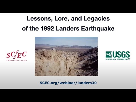
SCEC video on the 1992 Landers earthquake, thumbnail

Pictured: a SCEC video on the 1992 Landers earthquake, tied #4 at Mw 7.3.

Rank Earthquake Magnitude (Mw) Date Region / fault Depth Deaths Notes
11857 Fort Tejon earthquake7.9 (est.)9 Jan 1857Central California: San Andreas fault, Parkfield to Wrightwoodunder 102Pre-instrumental estimate; epicenter assumed, not measured
11906 San Francisco earthquake7.918 Apr 1906Northern California: San Andreas fault, San Juan Bautista to Cape Mendocino8 km700 to 3,000+USGS Mw 7.9; published estimates 7.7 to 8.3; fires did most of the damage
31872 Owens Valley earthquake7.4 (est.)26 Mar 1872Eastern Sierra: Owens Valley and Lone Pine faults—27USGS-ANSS lists 7.4; estimates run to 7.9; no depth in our source
41927 Lompoc earthquake (offshore)7.34 Nov 1927Offshore: Offshore Santa Barbara County, near the Hosgri fault (location debated)10 km0Offshore. USGS gives 7.3; a tsunami-based estimate is 7.0; produced a 2 m tsunami
41952 Kern County earthquake7.321 Jul 1952Central California: White Wolf fault, southern San Joaquin Valley16 km12USGS catalog lists M 7.5 (a surface-wave magnitude); 14 deaths in some counts
41980 Eureka earthquake (offshore)7.38 Nov 1980Offshore: Offshore, Gorda plate, 60 km west of Patrick's Point10 km0Offshore. Six people injured when overpass spans fell at Fields Landing
41992 Landers earthquake7.328 Jun 1992Southern California: Johnson Valley, Homestead Valley, Emerson and Camp Rock faults (Mojave Desert)1.1 km3Some USGS publications give 7.4; a Mw 6.5 Big Bear shock followed the same day
81992 Cape Mendocino earthquake7.225 Apr 1992Northern California: Thrust on the Cascadia subduction zone, near Petrolia10.5 km0 reportedOnshore mainshock; Mw 6.5 and 6.6 aftershocks offshore next day; 98 to 356 injured
91999 Hector Mine earthquake7.116 Oct 1999Southern California: Lavic Lake and Bullion faults (Mojave Desert)13.7 km0USGS depth 13.7 km; Wikipedia says 20 km; remote area, 4 to 5 minor injuries
92019 Ridgecrest earthquake7.15 Jul 2019Southern California: Little Lake fault zone, Eastern California Shear Zone8 km1One death, indirect, in Nevada; Mw 6.4 foreshock on 4 Jul; $5.3 billion damage
112024 Cape Mendocino earthquake (offshore)7.05 Dec 2024Offshore: Offshore, Mendocino fault zone, about 70 km southwest of Ferndale10 km0Offshore. Strongest California-region quake since Ridgecrest; tsunami warning issued then canceled
121940 Imperial Valley (El Centro) earthquake6.918 May 1940Southern California: Imperial fault16 km9Depth sources disagree (USGS page 6.0 km, Wikipedia 16 km)
121989 Loma Prieta earthquake6.917 Oct 1989Central California: Unnamed oblique-slip fault next to the San Andreas, Santa Cruz Mountains19 km63Cypress Street Viaduct collapse killed 42; struck before Game 3 of the World Series
141925 Santa Barbara earthquake6.8 (est.)29 Jun 1925Central California: Probably the Mesa or Santa Ynez fault system (mechanism uncertain)—13Estimates range from 6.5 (Hough and Martin 2018) to 6.8 (ISC-GEM); Sheffield Dam failed
142014 Eureka earthquake (offshore)6.89 Mar 2014 (local)Offshore: Offshore, Mendocino fault zone, about 50 miles west of Eureka16.4 km0Offshore. Initially reported as 6.9; depth varies by source; no injuries or damage reported on land
161994 Northridge earthquake6.717 Jan 1994Southern California: Northridge blind thrust (Pico thrust)18.2 km5757 official deaths, estimates up to 72; $13 to 50 billion damage
171971 San Fernando earthquake6.69 Feb 1971Southern California: Sierra Madre fault zone8.4 km58 to 65Olive View Hospital nearly collapsed; 58 deaths directly attributed
172003 San Simeon earthquake6.622 Dec 2003Central California: Blind thrust, Oceanic fault zone (Santa Lucia Mountains)16 km2Both deaths in the Acorn Building collapse in Paso Robles

How we rank: by moment magnitude (Mw), the figure USGS and most seismologists use for large quakes. An earthquake counts if its epicenter is in California or its offshore waters; offshore ones are marked in the name and Region column, and Mexican events such as the 2010 El Mayor-Cucapah earthquake are left out. Each earthquake is one row, so aftershocks like the Mw 6.6 shock of 26 April 1992 are not listed separately. Ties share a rank and sort by date. Pre-instrumental quakes (1857, 1872) have magnitudes inferred from damage and fault offsets, so treat them as estimates. We left out events whose sources disagree or that we could not open: the 1 September 1994 offshore Mendocino fault quake (listed as 7.0 or 7.2 by different agencies)[26] and the Ms 7.2 Humboldt County earthquake of 1923. As of 20 November 2026 we found no 2025 or 2026 earthquake of Mw 6.5 or more in California; the strongest in 2026 was a preliminary M 5.6 near Willits on 24 June.[27] Magnitudes come from USGS pages where we could see them and otherwise from Wikipedia articles that cite USGS; depths and death counts follow Wikipedia unless noted, and death counts vary by source.[1]

The Top 10

#1 (tie)

1857 Fort Tejon earthquake — Mw 7.9

The Fort Tejon earthquake struck on 9 January 1857 and ruptured the San Andreas fault for about 350 km, from Parkfield to Wrightwood, with a moment magnitude of 7.9.[3] USGS says its maximum and average displacements were larger than in 1906.[2] Only two deaths were reported, partly because the region was thinly settled.[3] Its size is a modern estimate: the epicenter is assumed, not measured, and foreshock and mainshock times in 1857 newspapers can differ by up to half an hour.[3]

#1 (tie)

1906 San Francisco earthquake — Mw 7.9

USGS lists the 18 April 1906 earthquake at Mw 7.9, and published estimates run from 7.7 to 8.3.[4][5] The San Andreas fault broke for about 476 km at a depth of roughly 8 km.[4] Deaths are put at 700 to more than 3,000, and San Francisco's Board of Supervisors recognized 3,000+ in 2005, since deaths in Chinatown went largely unrecorded.[4] Fires burned for four days, destroying about 25,000 buildings on 490 blocks and causing most of the damage.[4]

#3

1872 Owens Valley earthquake — Mw 7.4

The USGS-ANSS catalog lists the 26 March 1872 Owens Valley earthquake at Mw 7.4, while published estimates run from 7.4 to 7.9, so we mark it as an estimate.[6] The Lone Pine and Owens Valley faults slipped about 15 to 20 ft vertically and 35 to 40 ft sideways.[6] The quake killed 27 and injured 56, and in Lone Pine 52 of 59 houses were destroyed.[6]

#4 (tie)

1927 Lompoc earthquake — Mw 7.3 (offshore)

The 4 November 1927 earthquake was centered offshore of Santa Barbara County, and its location is debated: sources place it between Point Sal and well west of Point Arguello.[7] USGS gives Mw 7.3, but a tsunami-based study (Satake and Somerville) estimates 7.0, so the figure is uncertain.[7] No one was killed, but a 2 m tsunami damaged railroad facilities at Surf and was recorded in Hawaiʻi.[7] It counts here because its epicenter was in California's offshore waters.

#4 (tie)

1952 Kern County earthquake — Mw 7.3

The 21 July 1952 earthquake on the White Wolf fault, in the southern San Joaquin Valley, has a moment magnitude of 7.3 and a surface-wave magnitude of 7.5, at a depth of 16 km.[8] The USGS catalog lists it as M 7.5, which is why you will see both figures.[9] Wikipedia gives 12 deaths in its text and 14 in its infobox, with hundreds injured and property damage of about $60 to $70 million.[8]

#4 (tie)

1980 Eureka earthquake — Mw 7.3 (offshore)

This 8 November 1980 earthquake was centered offshore, about 60 km west of Patrick's Point, at a depth of 10 km.[10] It was a left-lateral strike-slip rupture within the Gorda plate.[10] Six people were injured when two spans of the Tompkins Hill Road overpass at Fields Landing fell from their supports; our source mentions no deaths.[10]

#4 (tie)

1992 Landers earthquake — Mw 7.3

The Landers earthquake hit the Mojave Desert at 4:57 a.m. on 28 June 1992 and broke several faults, including the Johnson Valley, Homestead Valley, Emerson and Camp Rock faults.[11] Surface rupture ran about 70 km, with a maximum horizontal offset of 5.5 m.[11] Three people died and more than 400 were hurt.[11] USGS pages carry it as M 7.3, though one USGS publication titles it M 7.4.[12] The video is a SCEC lecture on the earthquake's lessons and legacy.

#8

1992 Cape Mendocino earthquake — Mw 7.2

The 25 April 1992 mainshock was onshore, about 4 km west of Petrolia, at a depth of 10.5 km, on a thrust fault consistent with the Cascadia subduction zone.[13] The next day two offshore aftershocks of Mw 6.5 and 6.6 struck in the Gorda plate, about 30 km farther west.[13] The sequence injured an estimated 98 to 356 people, and our source reports no deaths.[13] We rank the mainshock only and leave out the aftershocks.

#9 (tie)

1999 Hector Mine earthquake — Mw 7.1

At 2:46 a.m. on 16 October 1999, the Lavic Lake and Bullion faults in the Mojave Desert ruptured with right-lateral slip.[14] It was preceded by 12 foreshocks, the largest of magnitude 3.8.[15] It caused no deaths, with 4 to 5 minor injuries, because the area is sparsely populated.[14] Depth is 13.7 km on the USGS event page and 20 km in Wikipedia.[14][15]

#9 (tie)

2019 Ridgecrest earthquake — Mw 7.1

The Mw 7.1 mainshock struck at 8:19 p.m. PDT on 5 July 2019, a day after a Mw 6.4 foreshock, at a depth of 8 km on the Little Lake fault zone.[16][17] Aftershocks stretched about 50 km along the fault.[16] One death was recorded, in Pahrump, Nevada, when a Jeep fell on a man working under it, and 25 people were injured; total damage is estimated at $5.3 billion.[16] The video is a KTLA news report from the aftermath.

Ranks 11 to 18

Ranks 11 to 18 are smaller but include California's deadliest. The December 2024 offshore Cape Mendocino earthquake was Mw 7.0 at a depth of 10 km, on the Mendocino fault zone about 70 km southwest of Ferndale; it killed no one and a tsunami warning was canceled.[18] The 1989 Loma Prieta earthquake (Mw 6.9, 63 deaths) killed 42 people when the Cypress Street Viaduct collapsed and caused about $5.6 to 6 billion in damage.[19] The 1940 Imperial Valley earthquake (Mw 6.9) killed 9 and moved the Imperial fault up to 4.5 m.[20] The 1925 Santa Barbara earthquake killed 13 and failed the Sheffield Dam; its magnitude is uncertain, from 6.5 to 6.8.[21] The 2014 offshore Eureka earthquake (Mw 6.8, about 50 miles west of Eureka) caused no reported injuries or damage on land.[22] Northridge in 1994 (Mw 6.7) has 57 official deaths, more than 8,700 injuries and $13 to 50 billion in damage.[23] San Fernando in 1971 (Mw 6.6) killed 58 to 65, and San Simeon in 2003 (Mw 6.6) killed two when the Acorn Building in Paso Robles collapsed.[24][25]

Earthquakes California San Andreas Fault Geology Natural Disasters USGS Records
Next rankingThe Deepest Ocean Trenches in the World

🎲 Surprise me with a random ranking

Sources

  1. Wikipedia, “List of earthquakes in California” (magnitudes, dates and death counts for the full candidate list; the 2024 event is listed with magnitude 7.0 and no deaths.)
  2. USGS, “M7.9 1857 Fort Tejon earthquake” (displacements compared with 1906, as shown in search results.)
  3. Wikipedia, “1857 Fort Tejon earthquake” (Mw 7.9, rupture length, deaths, timing and epicenter uncertainty.)
  4. Wikipedia, “1906 San Francisco earthquake” (Mw range 7.7 to 8.3, rupture length, deaths, fire.)
  5. USGS event page, “M 7.9 – The 1906 San Francisco, California Earthquake” (Mw 7.9, from Song, Beroza and Segall 2008, as shown in search results.)
  6. Wikipedia, “1872 Owens Valley earthquake” (Mw 7.4 per USGS-ANSS, range 7.4 to 7.9, deaths, fault displacement.)
  7. Wikipedia, “1927 Lompoc earthquake” (USGS 7.3 versus 7.0 from tsunami data, offshore location, tsunami.)
  8. Wikipedia, “1952 Kern County earthquake” (Mw 7.3, Ms 7.5, depth, deaths, damage.)
  9. USGS event page, “M 7.5 – The 1952 Kern County, California Earthquake” (the catalog's M 7.5, as shown in search results.)
  10. Wikipedia, “1980 Eureka earthquake” (Mw 7.3, offshore location, depth, injuries.)
  11. Wikipedia, “1992 Landers earthquake” (Mw 7.3, faults, rupture, slip, casualties.)
  12. USGS, “M7.3 June 28, 1992 Landers earthquake” (USGS page title, and a USGS publication that gives M 7.4, as shown in search results.)
  13. Wikipedia, “1992 Cape Mendocino earthquakes” (Mw 7.2 mainshock, aftershocks, depth, injuries.)
  14. Wikipedia, “1999 Hector Mine earthquake” (Mw 7.1, faults, deaths, injuries.)
  15. USGS event page, “M 7.1 – The 1999 Hector Mine, California Earthquake” (depth 13.7 km, as shown in search results; foreshocks per Wikipedia.)
  16. Wikipedia, “2019 Ridgecrest earthquakes” (foreshock, mainshock, deaths, injuries, cost.)
  17. USGS event page, “M 7.1 – Ridgecrest Earthquake Sequence” (Mw 7.1 and depth 8.0 km, as shown in search results.)
  18. USGS event page, “M 7.0 – 2024 Offshore Cape Mendocino, California Earthquake” (Mw 7.0, depth 10 km, Mendocino fault zone, as shown in search results; the canceled tsunami warning is from an ABC News story listed in the same results.)
  19. Wikipedia, “1989 Loma Prieta earthquake” (Mw 6.9, deaths, Cypress Street Viaduct, damage.)
  20. Wikipedia, “1940 El Centro earthquake” (Mw 6.9, deaths, slip; USGS gives 6.0 km depth for the same event.)
  21. Wikipedia, “1925 Santa Barbara earthquake” (Mw 6.5 to 6.8, deaths, dam failure.)
  22. UC Berkeley Seismology Lab blog, March 2014 offshore Mendocino earthquake (Mw 6.8, location; depth and the initial 6.9 figure vary across sources, as shown in search results.)
  23. Wikipedia, “1994 Northridge earthquake” (Mw 6.7, deaths, injuries, cost.)
  24. Wikipedia, “1971 San Fernando earthquake” (Mw 6.6, deaths, Olive View Hospital.)
  25. Wikipedia, “2003 San Simeon earthquake” (Mw 6.6, deaths, Paso Robles.)
  26. California Geological Survey, strong-motion data from the 1 September 1994 offshore Eureka earthquake (lists ML 6.8 and an NEIC Mw of 7.2, versus 7.0 in USGS weekly reports, as shown in search results.)
  27. AP via The Atlanta Journal-Constitution, June 2026 Willits earthquake (preliminary USGS M 5.6, as shown in search results.)
  28. Video: the Landers lecture (SCEC YouTube channel) and the Ridgecrest news report (KTLA 5); both IDs checked with YouTube oEmbed. No verified video was found for the other entries, so they have no embed.