Japan’s Kikai caldera erupted about 170 km³ of tephra roughly 7,300 years ago, the largest eruption since the last ice age. These are 12 eruptions of the Holocene, the past 11,700 years, ranked by bulk tephra volume.
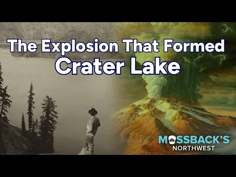
Pictured: a still from Cascade PBS’s “Mount Mazama Blows Its Top”, on the eruption that formed Crater Lake; Mazama is #5 in this ranking, with about 120 km³ of bulk tephra in the table (a 2020 re-estimate gives 176), while #1 Kikai–Akahoya has no authoritative video.
Rank
Eruption / volcano
Approx. date
Bulk tephra (km³)
VEI
Country
Notes (DRE, where sourced)
1
Kikai Caldera (Akahoya eruption)
~7,300 years ago (c. 5350–5215 BCE)
~170
7
Japan
Ryukyu Islands; DRE 133–183 km³; one 2007 study put the ejected volume at 332–457 km³
2
Cerro Blanco
~4,200 years ago (c. 2300 BCE)
~170 (110–172)
7
Argentina
Central Andes; one estimate gives 83 km³ DRE; tied with Kikai within error
3
Mount Tambora
10 April 1815
150–175
7
Indonesia
Sumbawa; DRE 37–45 km³; the “Year Without a Summer”
4
Kurile Lake (Ilyinsky eruption)
~8,400 years ago (c. 6460–6415 BCE)
~155 (140–170)
7
Russia
Southern Kamchatka; DRE not found
5
Mount Mazama (Crater Lake)
~7,700 years ago
~120
7
United States
Oregon; a 2020 re-estimate gives 176 km³ bulk, about 61 km³ DRE
6
Taupō (Hatepe eruption)
c. 232 CE (dating disputed)
~110 (45–105 in other sources)
7
New Zealand
Lake Taupō, North Island; about 30 km³ erupted in 6–7 minutes
7
Mount Samalas
c. 1257 CE
81–92
7
Indonesia
Lombok; DRE 33–40 km³; source of the 1257 ice-core sulfate spike
8
Novarupta
6–8 June 1912
28–30
6
United States
Alaska; DRE 13–15 km³; largest eruption of the 20th century
9
Krakatoa
26–27 August 1883
18–25
6
Indonesia
Sunda Strait; DRE about 9–12.5 km³; tsunamis killed tens of thousands
10
Hunga Tonga–Hunga Haʻapai
15 January 2022
10–14
6
Tonga
Submarine volcano; DRE about 7 km³ in the list, other studies give far less ejecta
11
Santa María
24 October 1902
10.7–11.4
6
Guatemala
DRE about 6.4 km³; forms the Santiaguito dome complex
12
Mount Pinatubo
15 June 1991
10.4–11.0
6
Philippines
Luzon; DRE about 5 km³; cooled the planet by about 0.5°C
No matching rows.
Read this first: the scope is the Holocene (the past 11,700 years), where eruption deposits are best preserved and the Volcanic Explosivity Index (VEI) record is most reliable. The table holds every Holocene VEI 7 eruption that has a published volume and a second source, plus the VEI 6 eruptions since 1800 CE that have measured volumes. Older super-eruptions such as Toba (about 74,000 years ago, roughly 2,800 km³ DRE, VEI 8), Yellowstone’s Huckleberry Ridge (about 2.1 million years ago, roughly 2,450 km³) and Taupō’s Oruanui (about 25,500 years ago, roughly 1,170 km³) were larger, but they are a separate Pleistocene class and are not ranked here. The rank column is bulk tephra volume in cubic kilometres, the deposit as measured in the field, which is the figure in Wikipedia’s List of large Holocene volcanic eruptions, itself drawn from the Smithsonian Global Volcanism Program’s Holocene eruption data. Where the list gives a range, the table shows it and ranks on the midpoint. Dense-rock equivalent (DRE), the volume once pore space is removed, is shown in the notes where a source gives it, and bulk and DRE are never mixed in the rank. Volumes carry large uncertainty and ranks can change with new studies: Kikai and Cerro Blanco are tied within error, and Mazama would move to first on a 2020 re-estimate of 176 km³.[1][3] The Smithsonian site could not be opened from here, so every figure comes from Wikipedia’s list and the volcano articles, checked against each other and, for Mazama and Hunga Tonga, against the studies they cite; treat each as a good estimate rather than a measurement. Dates are approximate: prehistoric ones are radiocarbon or tree-ring ages with margins of decades to centuries, and the Hatepe date is disputed. Left out because their figures conflict between sources or have no second source: the Minoan eruption of Santorini (about 28–41 km³ DRE; the list’s 34.5 km³ appears to be a DRE figure), Taal’s Pasong ignimbrite (144 km³, listed as bulk in one place and DRE in another), Fisher Caldera, Semisopochnoi and Macauley Island. VEI 6 eruptions before 1800 are also left out, including Baekdu in 946 CE, Ilopango in about 430 CE and Huaynaputina in 1600. Earthquakes are ranked in The Largest Earthquakes Ever Recorded.
The Top 10
#1
Kikai Caldera (Akahoya) — ~170 km³
Off southern Kyushu, Japan, the Akahoya eruption about 7,300 years ago formed the present Kikai caldera and is generally ranked the largest eruption of the past 11,700 years. Wikipedia’s list gives about 170 km³ of bulk tephra; its Kikai article gives more than 150 km³ bulk and 133–183 km³ DRE, and a 2007 survey of the seabed put the ejected volume at 332–457 km³, so it keeps first place over Cerro Blanco despite the near-tie. The clip is a Lund University video that its description says covers the eruption’s effect on societies; it was matched from search-result text and not watched, so treat its topic as likely, not certain.[1][2]
#2
Cerro Blanco — ~170 km³
This caldera in Catamarca, Argentina, produced the largest Holocene eruption of the Central Andes about 4,200 years ago, spreading tephra over roughly 500,000 km² to the east-southeast. Wikipedia’s list gives 172 km³ and its article says about 170 km³ of tephra, while another estimate in the same article is 110 km³ (with 83 km³ DRE), so this figure is a loose upper bound. No suitable video from an authoritative channel was found, so the icon is shown instead.[1][2]
#3
Mount Tambora — 150–175 km³
The eruption of 10 April 1815 on Sumbawa, Indonesia, is the largest confirmed eruption in recorded history. Wikipedia’s list gives 150–175 km³ of bulk tephra and 37–50 km³ DRE, and its article says 37–45 km³ DRE, with 10,000–11,000 direct deaths. Sulfur aerosols cooled the climate and led to 1816’s “Year Without a Summer”. The videos found for Tambora were from independent uploaders, not an authoritative channel, so the icon is shown.[1][2]
#4
Kurile Lake (Ilyinsky) — ~155 km³
In southern Kamchatka, Russia, the Ilyinsky eruption around 6460–6415 BCE formed the Kurile Lake caldera and spread ash as far as 1,700 km. The list gives 155 km³ and the lake’s article 140–170 km³, with a VEI of 7. It is the least documented of the top four, and no DRE figure was found. No suitable video from an authoritative channel was found, so the icon is shown instead.[1][2]
#5
Mount Mazama (Crater Lake) — ~120 km³
About 7,700 years ago, Mazama in Oregon emptied its magma chamber and collapsed to form the caldera that now holds Crater Lake. The list gives about 120 km³ and USGS describes roughly 50 km³ of magma; a 2020 University of Bristol study of more than 250 tephra sites revised the bulk volume to about 176 km³ (about 61 km³ DRE), which would put it first here. The clip is Cascade PBS’s explainer on the eruption.[1][3][4]
#6
Taupō (Hatepe) — ~110 km³
The Hatepe eruption of Lake Taupō in New Zealand is VEI 7 and the island nation’s largest eruption in the last 20,000 years. The list gives 110 km³ and the Hatepe article 45–105 km³ of bulk tephra, with just over 30 km³ thrown out in 6–7 minutes. The traditional date of about 232 CE comes from tree-ring work, but another radiocarbon study argues it could be younger. No suitable video from an authoritative channel was found, so the icon is shown instead.[1][2]
#7
Mount Samalas — 81–92 km³
The 1257 eruption on Lombok, Indonesia, left a 6.5 by 8 km caldera now occupied by Segara Anak lake beside Rinjani. It was identified as the source of the huge sulfate spike in polar ice cores that had long been unexplained. The list gives 81–92 km³ bulk and 33–40 km³ DRE. The videos found were from independent channels, so the icon is shown.[1][2]
#8
Novarupta — 28–30 km³
The June 1912 eruption in Alaska is the largest of the 20th century, about 30 times the 1980 Mount St. Helens eruption, and it created the Valley of Ten Thousand Smokes. The list gives 28–30 km³ bulk, built from roughly 17 km³ of fall deposit plus 11 km³ of ash-flow tuff, and 13–15 km³ DRE. Mount Katmai’s summit collapsed nearby. The video is a University of Alaska Museum of the North segment on the eruption.[1][2]
#9
Krakatoa — 18–25 km³
The August 1883 eruption in the Sunda Strait produced about 20 km³ of tephra and 18–21 km³ of ignimbrite by the figures in its article, and sound heard thousands of kilometres away. The list gives 18–25 km³ bulk and about 9–12.5 km³ DRE. The video is a HISTORY channel documentary episode, a broadcaster rather than a science agency.[1][2]
#10
Hunga Tonga–Hunga Haʻapai — 10–14 km³
The 15 January 2022 eruption of the submarine volcano in Tonga is the largest of the satellite era by atmospheric disturbance, but its volume is the least settled in the table: the list gives 10–14 km³ bulk and about 7 km³ DRE, while its article cites 1.9 km³ of ejecta and 6–7 km³ of debris on the seafloor, so its rank could fall. The video is a NASA Goddard feature on the volcanic island, not only on the eruption itself.[1][2]
Videos: Lund University, Cascade PBS, UA Museum of the North, HISTORY and NASA Goddard on YouTube; each ID was checked for channel and title. The Kikai video’s topic rests on search-result text, and the Cerro Blanco, Kurile Lake, Taupō, Samalas, Tambora and Pinatubo entries show the icon because no authoritative video was verified.