Geography & Countries
The Tallest Mountains in Asia
Asia doesn't just contain the world's tallest mountain — it contains all fourteen 8,000-metre peaks on Earth, all packed into the Himalaya and the Karakoram. Ranked by elevation above sea level.
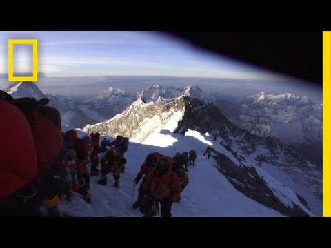
Pictured: Mount Everest, #1 at 8,849 m.
The Top 10
#1
Everest — 8,849 m
Called Sagarmatha in Nepal and Chomolungma in Tibet, Everest sits directly on the Nepal–China border and is climbed from both sides via very different route styles. Its English name honors Sir George Everest, the British surveyor-general credited by his successor in 1856, even though Everest himself reportedly never laid eyes on the mountain.[1]
#2
K2 — 8,611 m
K2 sits on the Pakistan–China border in the Karakoram, a different range entirely from the rest of this top five, and has no easy route to its summit — every side is a serious technical climb. Its terse name dates to an 1856 survey of the range by Thomas Montgomerie, who labeled its two most prominent peaks K1 and K2 for lack of a known local name; K1 turned out to have one, Masherbrum, but K2's never surfaced.[2]
#3
Kangchenjunga — 8,586 m
Straddling Nepal and the Indian state of Sikkim, Kangchenjunga is worshipped as a guardian deity locally, which is part of why several expeditions have chosen to halt just below the literal high point. In 1905, an expedition led by the British occultist Aleister Crowley ended in disaster when an avalanche killed four of its members, a tragedy some in the party blamed on the mountain's guardian demon.[3]
#4
Lhotse — 8,516 m
Lhotse's name means "South Peak" in Tibetan, describing its position relative to Everest, which looms immediately to its north across the shared South Col. Beyond the main summit, the massif also holds two named subsidiary peaks above 8,000 m, Lhotse Middle and Lhotse Shar, making it one of only a handful of mountains anywhere with multiple independent 8,000-metre points.[4]
#5
Makalu — 8,485 m
Makalu rises about 19 km southeast of Everest in Nepal, and its sharp pyramidal form makes it one of the more instantly recognizable peaks in the Himalaya, despite being climbed far less often. Its name is thought to derive from the Sanskrit Maha Kala, or "Great Black One," an epithet for the Hindu god Shiva.[5]
#6
Cho Oyu — 8,188 m
Rising near the Nepal–Tibet border just west of the Khumbu region, Cho Oyu is climbed by far more people than any other 8,000-metre peak besides Everest, largely because its standard route avoids serious technical climbing. That accessibility has made it a common acclimatization climb for mountaineers training for Everest, despite Cho Oyu ranking as the sixth-highest peak in the world in its own right.[6]
#7
Dhaulagiri I — 8,167 m
Dhaulagiri anchors the western end of Nepal's Himalaya and towers over the Kali Gandaki gorge below it, one of the deepest gorges on the planet, carved between Dhaulagiri and Annapurna on opposite sides. It also anchors a wider massif of its own, with four named subsidiary peaks, Dhaulagiri II through V, each still well above 7,000 m.[7]
#8
Manaslu — 8,163 m
Manaslu sits in the Mansiri Himal section of central Nepal and has become one of the more heavily commercially guided 8,000-metre peaks in recent years, drawing large expedition numbers each autumn season. Unlike most of its Himalayan neighbors, it lies entirely within Nepal's own borders, rather than straddling a frontier with Tibet or India.[8]
#9
Nanga Parbat — 8,126 m
Standing alone at the western end of the Himalaya in Pakistan, Nanga Parbat has one of the largest vertical rises of any mountain on Earth, towering roughly 7,000 m above the Indus River valley just to its north. Its south side, the Rupal Face, climbs about 4,600 m from base to summit in a single sweep, making it one of the tallest mountain faces anywhere on Earth.[9]
#10
Annapurna I — 8,091 m
Annapurna presides over a wide massif in central Nepal that also includes several other 7,000-metre peaks, and the trekking route that circles beneath it, the Annapurna Circuit, is one of the most popular long-distance treks in the world. The mountain takes its name from the Hindu goddess of food and nourishment, a fitting namesake for a massif whose slopes feed some of Nepal's most fertile farmland below.[10]
Sources
- China–Nepal joint 2020 survey of Mount Everest's elevation, general eight-thousander/Himalaya elevation data, and the mountain's naming history, aggregated from national survey and mountaineering-record sources.
- K2 geography, route history, and naming history, aggregated from mountaineering historical sources.
- Kangchenjunga cultural and geographic background, and the 1905 Crowley expedition, aggregated from mountaineering historical sources.
- Lhotse geography and subsidiary-peak data, aggregated from mountaineering reference sources.
- Makalu geography and naming background, aggregated from mountaineering reference sources.
- Cho Oyu ascent statistics and route background, aggregated from mountaineering reference sources.
- Dhaulagiri geography, the Kali Gandaki gorge, and the Dhaulagiri massif's subsidiary peaks, aggregated from geographic reference sources.
- Manaslu commercial expedition trends and geography, aggregated from mountaineering reference sources.
- Nanga Parbat topographic relief, including the Rupal Face, aggregated from mountaineering reference sources.
- Annapurna massif geography, the Annapurna Circuit trekking route, and the mountain's naming background, aggregated from geographic reference sources.