Most of Africa drives on the right, but a solid block of 14 countries in the south and east keeps left, plus two British island territories in the South Atlantic. In all of them cars are right-hand drive. This unranked list covers each one, grouped by area, with the neighbours that drive on the right, which tells you where you'll have to switch sides at a border.
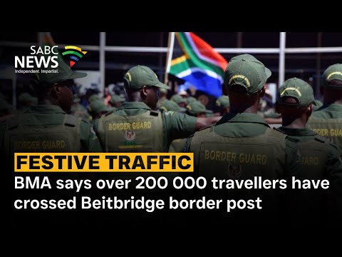
Pictured: festive-season traffic at the Beitbridge border post, where South Africa's N1 meets Zimbabwe. Both countries drive on the left (Southern Africa).
Country / territory
Area
Type
Capital
Neighbours driving on the right
Traveller note
Botswana
Southern Africa
Sovereign state
Gaborone
None
The Kazungula Bridge (2021) links it to Zambia; all neighbours keep left
Eswatini
Southern Africa
Sovereign state
Mbabane
None
Borders only South Africa and Mozambique, both left-hand
Lesotho
Southern Africa
Sovereign state
Maseru
None
Completely surrounded by South Africa
Malawi
Southern Africa
Sovereign state
Lilongwe
None
All three neighbours (Mozambique, Tanzania, Zambia) keep left
Mozambique
Southern Africa
Sovereign state
Maputo
None
The only Portuguese-speaking country that drives on the left
Namibia
Southern Africa
Sovereign state
Windhoek
Angola
Much of the network is gravel; keep to 80 km/h or less on it
South Africa
Southern Africa
Sovereign state
Pretoria
None
The N1 runs about 1,940 km from Cape Town to Beitbridge
Zambia
Southern Africa
Sovereign state
Lusaka
Angola, DR Congo
Switch sides at Kasumbalesa, the main crossing into DR Congo
Zimbabwe
Southern Africa
Sovereign state
Harare
None
Beitbridge, at the top of South Africa's N1, needs no switch
Kenya
East Africa
Sovereign state
Nairobi
Ethiopia, Somalia, South Sudan
Switch sides at Moyale, the one-stop border post into Ethiopia
Tanzania
East Africa
Sovereign state
Dodoma
Burundi, Rwanda (DR Congo across Lake Tanganyika)
Switch sides driving into Rwanda or Burundi
Uganda
East Africa
Sovereign state
Kampala
DR Congo, Rwanda, South Sudan
Switch sides at Katuna–Gatuna, the main crossing into Rwanda
Mauritius
Indian Ocean islands
Sovereign state
Port Louis
None (island)
Island nation; no land borders
Seychelles
Indian Ocean islands
Sovereign state
Victoria
None (island)
Island nation; no land borders
Saint Helena
South Atlantic islands
British overseas territory
Jamestown
None (island)
Visitors can drive on their home licence for up to 3 months
Ascension Island
South Atlantic islands
British overseas territory
Georgetown
None (island)
A UK photocard licence is valid for 3 months, then a local one is needed
No matching rows.
Highlights
Southern Africa
South Africa: the N1 to Beitbridge
South Africa's N1 runs about 1,940 km from Cape Town through Bloemfontein, Johannesburg and Pretoria to Beitbridge on the Limpopo River. It is the country's second-longest national route, after the N2. Beitbridge is South Africa's busiest land port, and in one festive season the Border Management Authority counted more than 200,000 travellers crossing there into Zimbabwe. Zimbabwe also drives on the left, so drivers stay on the same side.[1]
Southern Africa
Namibia: gravel roads and a late switch
Namibia is one of the few places that has ever moved from the right side of the road to the left. South Africa brought in left-hand traffic after taking over German South West Africa in the First World War, usually dated to 1920. Today much of its road network is gravel. Canada's travel advice says not to go over 80 km/h on gravel and warns that tourists are often in single-vehicle crashes, and GOV.UK recommends comprehensive insurance for the same reason. Angola, to the north, drives on the right.[2]
Southern Africa
Botswana & Zambia: the Kazungula Bridge
Until 2021, drivers between Botswana and Zambia crossed the Zambezi on a pontoon ferry. The 923-metre Kazungula road-and-rail bridge, opened on 10 May 2021 at a cost of about $259 million, replaced it. It has a one-stop border post at each end and gives trucks a route that avoids the congested Beitbridge crossing. Both countries drive on the left, so there's no switch.[3]
Southern Africa
Zambia: switching sides at Kasumbalesa
About 30 km north of Chingola, Kasumbalesa is the main road crossing between Zambia and the DR Congo's copper belt around Lubumbashi and Kolwezi. Here drivers move from left-hand to right-hand traffic. Almost all of Congo's copper leaves by road through Zambia, and truck queues at the post have stretched 48 to 60 km at their worst.[4]
East Africa
Kenya: the Moyale crossing to Ethiopia
Moyale is a market town split between Kenya and Ethiopia, and it's where traffic changes from left to right. President Uhuru Kenyatta and Prime Minister Abiy Ahmed opened its one-stop border post on 9 December 2020, along with about 500 km of new road on the Ethiopian side. The post was funded by the African Development Bank and the UK government, and it is the only one-stop post on the two countries' 830-plus km border.[5]
East Africa
Uganda: Katuna–Gatuna and the Rwanda question
The Katuna–Gatuna post is the main road crossing between left-driving Uganda and right-driving Rwanda. It was closed in 2019 during a diplomatic dispute and reopened on 31 January 2022. Rwanda once studied joining its left-driving neighbours: a 2009 government feasibility study found a switch would bring substantial economic benefits, and surveys showed most Rwandans in favour. Rwanda still drives on the right.[6]
Southern Africa
Mozambique: the Portuguese exception
Portugal switched to right-hand traffic in 1928, and Angola, Cabo Verde, Guinea-Bissau and São Tomé and Príncipe switched with it. Mozambique, independent since 1975, kept driving on the left, which is usually explained by its land borders with British-ruled neighbours that drove on the left. Today it is the only Portuguese-speaking country on this list.[7]
South Atlantic islands
Saint Helena: give way going uphill
On this remote British island, visitors can drive on their own country's licence for up to three months a year. After that they need a St Helena licence, which has to be applied for in person in Jamestown. The roads are steep, narrow and winding, and the local rule is that cars going uphill give way to cars coming down, even if that means reversing a long way to a passing place. Hire firms are small, so book a car early.[8]
Wikipedia, "National routes in South Africa" (N1 length and termini); SABC News reports on Border Management Authority festive-season traffic at the Beitbridge border post.
GOV.UK foreign travel advice for Namibia (safety and security: driving and insurance); Government of Canada travel advice for Namibia (80 km/h on gravel, single-vehicle accidents); Wikipedia, "Left- and right-hand traffic" (South Africa introduced left-hand traffic in former South West Africa after World War I), and a chronology of traffic-side changes giving 1920.
Africanews, "Southern African regions inaugurate milestone Kazungula Bridge" (May 2021); Al Jazeera and Anadolu Agency coverage of the opening; Wikipedia, "Kazungula Bridge" and "Kazungula Ferry."
Reuters reporting via Mining Weekly/Engineering News, "Congo plans border post expansion as mining trucks endure up to 60 km queues" (July 2022); Bloomberg reporting on the 2024 Zambia–Congo border dispute (queues of more than 48 km); Freight News coverage of Kasumbalesa.
Business Daily Africa, "Uhuru, Abiy open Moyale border post to boost Kenya-Ethiopia trade" (December 2020); The Standard; Africanews, "Ethiopia and Kenya inaugurate new border post to boost trade"; The EastAfrican; Kenyans.co.ke on the Moyale post and on drivers switching sides at Kenya's borders.
Daily Monitor (Uganda), KT Press and The Conversation on the 2019 closure and January 2022 reopening of Gatuna–Katuna; Rwanda Ministry of Infrastructure feasibility study on switching driving side, published in European Transport Research Review (Springer, 2014), and SWOV's summary; The New Times (Rwanda) on the 2010 proposal and survey.
Wikipedia, "Left- and right-hand traffic" (Portugal's 1928 switch and Mozambique's exception); WorldAtlas, "Countries That Drive on the Left"; France 24 on Mozambique's 50 years of independence (25 June 1975).
Government of St Helena, driving licence applicant guidelines; GOV.UK foreign travel advice for St Helena, Ascension and Tristan da Cunha; Wanderlust St Helena travel guide; DriverAbroad St Helena and Ascension driving guides.
Table: World Standards, "List of left-driving countries"; Kayak and Confused.com lists of countries that drive on the left; Kenyans.co.ke, "Kenya Among 13 African Countries Where Drivers Use The Left Lane." Neighbours are drawn from each country's land borders; capitals are the seat of government (South Africa: executive capital Pretoria; Eswatini: administrative capital Mbabane). Tristan da Cunha, the third island of the St Helena territory, has only a short road within its one settlement, so it's left off; Mayotte and Réunion, the French islands, drive on the right.