Geography & Countries
The Wettest Places on Earth
López de Micay in Colombia (12,169 mm a year) narrowly tops Mawsynram in India (11,872 mm) and Cherrapunji (11,777 mm) on official long-term averages, though the order depends on the record you use. Here are 15 places ranked by average annual rainfall, as of 22 November 2026.
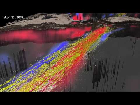
Pictured: a documentary video on Mawsynram, India, #2 at 11,872 mm a year.
How we rank: by long-term average annual precipitation from a weather-station record, not by single-year extremes. Single-year records, such as Cherrapunji’s roughly 26,000 mm in 1860–61 and Waiʻaleʻale’s 17,300 mm in 1982, are noted but not ranked.[3][8] Record periods differ (1912 to present down to 1978–2007), so places within a few percent of each other are effectively tied; the table orders them by the figure shown, with no ties. Sources conflict most for Lloró: a farm gauge reported 12,717 mm for 1952–1989, which would make it the wettest place on Earth, but IDEAM’s 1981–2010 average for the town is about 7,807 mm, so we rank the official figure.[11] We could not verify Mawsynram’s own record period; IMD series put it near 12,100–12,400 mm, which would place it first.[2] Most figures here come through Wikipedia articles that cite the weather services, as we could not open IDEAM, NIWA or NOAA tables directly. As of 22 November 2026.
The Top 10
#1
López de Micay, Colombia — 12,169 mm
Colombia’s weather service IDEAM reports an average of 12,168.9 mm a year for López de Micay from its 1991–2020 normals, which Wikipedia says could make it the wettest inhabited place in the world.[1] That puts it only about 2.5% above Mawsynram’s widely quoted figure, so the order at the top depends on which record and period you pick. An older claim of 12,892 mm a year (1960–2012) circulates for the same town, but we rank on the IDEAM normal.[2] We did not open IDEAM’s own table, so treat this figure as relayed through Wikipedia.
#2
Mawsynram, India — 11,872 mm
Mawsynram, in Meghalaya, has an average of 11,872 mm a year and is reportedly the wettest place on Earth.[2] India Meteorological Department records quoted by Wikipedia give 12,393 mm for 1950–2000 and 12,120 mm for 2000–2020, so by those series it would lead the table.[2] It sits at about 1,400 m, and on 17 June 2022 it set a one-day record of 1,003.2 mm in 24 hours.[2] Two Colombian places, Lloró and López de Micay, have been claimed to beat it.[2]
#3
Cherrapunji (Sohra), India — 11,777 mm
Cherrapunji, also called Sohra, lies at about 1,430 m on the Shillong Plateau and was long called the wettest place on Earth before Mawsynram took the title.[3] Its average of about 11,777 mm (1971–1990) comes from secondary summaries.[16] It still holds the records for the most rain in a calendar month, 9,300 mm in July 1861, and in a year, roughly 26,000 mm in 1860–61.[3] Those are single-period records, so we keep them out of the ranking. Wikipedia notes Cherrapunji shows a decreasing rainfall trend while Mawsynram’s is slightly rising.[2]
#4
Cropp River, New Zealand — 11,393 mm
The Cropp River is a catchment in New Zealand’s Southern Alps, and NIWA’s climate table gives it an average of 11,393 mm for 1981–2010.[4] It has no town, so it is a gauge reading rather than a place where people live. On 25–26 March 2019 it received 1,086 mm in 48 hours, described as a New Zealand record for that span.[4] NIWA annual summaries show individual years in a similar range, but gauges differ, and a short-term gauge estimate of 11,854 mm also exists, so we use the NIWA climate-table figure.[4]
#5
Tutunendó, Colombia — 10,486 mm
Tutunendó, a corregimiento of Quibdó in Chocó about 14 km from the city, is listed with 10,486 mm a year from IDEAM data labeled 1991–2020.[5] Its elevation is about 54 m and it has an extremely wet tropical rainforest climate.[5] A figure of about 11,770 mm is often repeated online, but we found no source for it and rank on the IDEAM-based table. Wikipedia’s page also says the climate source cites a 1981–2010 dataset, so the period is not fully consistent.[5]
#6
San Antonio de Ureca, Equatorial Guinea — 10,450 mm
Ureca, on Bioko island south of Malabo, averages about 10,450 mm a year, from the climate atlas of Bultot and Griffiths (1972).[6] Wikipedia calls it the wettest place in Africa, at an elevation of 186 m.[6] The record period is not stated. Cameroon’s Debundscha, across the Gulf of Guinea, is close behind.[7]
#7
Debundscha, Cameroon — 10,299 mm
Debundscha, a village at about 36 m beside Mount Cameroon, is credited with about 10,299 mm a year in a conservation-genetics textbook cited by Wikipedia.[7] The same page’s climate table lists 9,090 mm from a study of the Mount Cameroon region, so sources conflict by more than 1,000 mm.[7] Neither figure comes with a stated record period. It is usually named among the five rainiest places in the world alongside Mawsynram and Cherrapunji.[7]
#8
Big Bog, Maui, United States — 10,272 mm
Over 1978–2007 Big Bog on Maui averaged about 404 inches (10,300 mm) a year, making it the wettest measured spot in Hawaii on that comparison.[8] Weather Underground reports a 30-year mean of 404.4 inches at Big Bog against 393.3 inches at Mount Waiʻaleʻale for the same period.[9] We did not open the Big Bog article itself, so the figure rests on those two secondary accounts. It is a remote bog, not a community.
#9
Mount Waiʻaleʻale, Kauai, United States — 9,495 mm
NOAA and the Western Regional Climate Center put Waiʻaleʻale’s average since 1912 at 373.83 inches (9,495 mm), at 1,569 m.[8] The wettest year on record was 683 inches (17,300 mm) in 1982, which we mention but do not rank.[8] Older sources give higher averages, such as 460 inches for 1912–1945, because they use different periods.[8] NOAA lists about 289 days a year with at least 0.01 inch of rain.[8]
#10
Quibdó, Colombia — 8,157 mm
Quibdó, the capital of Chocó at 43 m, averages 8,156.9 mm a year in IDEAM’s 1991–2020 normals for El Caraño airport.[10] That is about two-thirds of the leaders’ rainfall. Tutunendó, a corregimiento of the same municipality, records more.[5]
Sources
- Wikipedia, “López de Micay” (IDEAM 1991–2020 average of 12,168.9 mm.)
- Wikipedia, “Mawsynram” (11,872 mm average, IMD series, 2022 record, Colombian claims.)
- Wikipedia, “Cherrapunji” (elevation, 1860–61 and July 1861 records.)
- Wikipedia, “Cropp River” (NIWA 1981–2010 average, 2019 record.)
- Wikipedia, “Tutunendó” (10,486 mm, IDEAM, elevation.)
- Wikipedia, “Ureca” (10,450 mm, Bultot and Griffiths (1972).)
- Wikipedia, “Debundscha” (10,299 mm versus 9,090 mm.)
- Wikipedia, “Mount Waiʻaleʻale” (NOAA 9,495 mm, 1982 record, Big Bog 404 inches.)
- Weather Underground, “New wettest location for the USA discovered” (1978–2007 Big Bog and Waiʻaleʻale means, as shown in search results.)
- Wikipedia, “Quibdó” (IDEAM 1991–2020, 8,156.9 mm.)
- Wikipedia, “Lloró” (12,717 mm claim (1952–1989) versus IDEAM 7,806.5 mm.)
- Wikipedia, “Henderson Lake (British Columbia)” (6,903 mm, 1997 record of 9,307 mm.)
- Wikipedia, “Bahía Solano” (about 5,737 mm.)
- Wikipedia, “Hilo, Hawaii” (NOAA 1991–2020 average, 3,058 mm.)
- Wikipedia, “Forks, Washington” (NOAA 1991–2020 average, 3,046 mm.)
- WorldAtlas, “The 10 Wettest Places on Earth” (Cherrapunji’s 11,777 mm (1971–1990), as summarized in search results; page not opened.)